

MONGOLIA DESTINATION
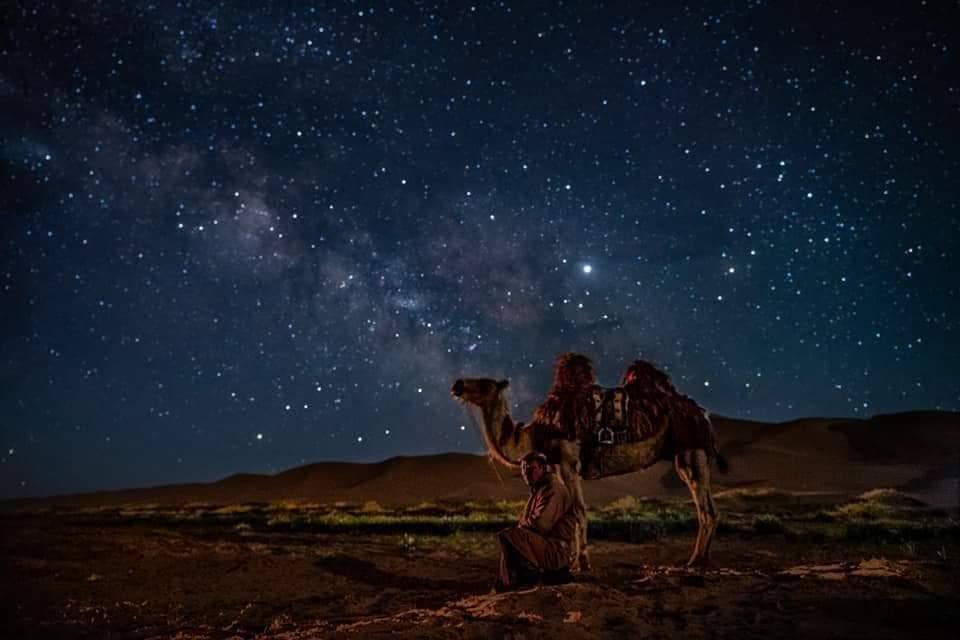
Mongolia is truly one of the world's last undiscovered travel destinations and the safest country to visit. It is a land where you can experience wide-open spaces, cobalt blue skies, forests, deserts, crystal clear rivers and lakes, and the traditional hospitality of the nomads. Permanent dwellings are few and far between, fences even fewer and the land is owned by the people, like one large National Park. As a tremendous destination to experience the outdoors, Mongolia also boasts of unique history dating back to the Mongol Empire of Genghis Khan. Simply put, it is a land of adventure, horses, nomads, and blue sky.
-
Central Mongolia
 Central Mongolia includes the most visited areas in countryside. This region has many historical sights , natural wonders in Mongolia’s heartland, particularly in the Orkhon River Valley, known as Orkhon Valley Cultural Landscape, which is an encompasses an extensive area of pastureland on both banks of the Orkhon River and includes numerous archaeological remains. It was registered by UNESCO in the World Heritage List as representing evolution of nomadic pastoral traditions spanning more than two millennia.
Another main part is Arkhangai province – has astounding scenery; wide rivers full of fish, several volcanoes and volcanic lakes, extensive forests, and pastures where yak thrive. It also boasts the stunning lake Terkhiin Tsagaan Nuur, the ruins of several ancient kingdoms.
Central Mongolia includes the most visited areas in countryside. This region has many historical sights , natural wonders in Mongolia’s heartland, particularly in the Orkhon River Valley, known as Orkhon Valley Cultural Landscape, which is an encompasses an extensive area of pastureland on both banks of the Orkhon River and includes numerous archaeological remains. It was registered by UNESCO in the World Heritage List as representing evolution of nomadic pastoral traditions spanning more than two millennia.
Another main part is Arkhangai province – has astounding scenery; wide rivers full of fish, several volcanoes and volcanic lakes, extensive forests, and pastures where yak thrive. It also boasts the stunning lake Terkhiin Tsagaan Nuur, the ruins of several ancient kingdoms.
Kharkhorin and Erdene Zuu Monastery

Former capital of Chinggis Khan, was founded 1220 in the Orkhon valley, center of the empire for more then 140 years, destroyed in 1391 by Chinese troups. Only two turtles of granite can be seen nowadays. The first Buddhist monastery in Mongolia, Erdene Zuu, was founded on the ruins of the old capital in the year 1586. It is surrounded by a quadratic wall (420m long on each side) with 108 stupas. In 1792, it housed 62 temples and 10.000 lamas. During communist area nearly destroyed, it contains today 3 temples, one stupa and some smaller buildings but became active monastery again and open for visitors. This is the place to "learn about religious and cultural traditions of Mongolia".
Orkhon Waterfall

Orkhon waterfall (also, called Ulaan Tsutgalan Waterfall) is one of the most visited tourist attractions in Central Mongolia. The height of the waterfall is about 20m (65 feet). The waterfall is located in a beautiful Orkhon river valley with volcanic rocks which listed in the UNESCO World Heritage Sites for its historical value related to Great Mongolian Empire. There is opportunity to experience their way of life, their culture and traditions. The area is ideal for fishing, horse riding, cycling and photography.
Elsen Tasarkhai Sand Dunes

Elsen Tasarkhai magnificent dunes are surrounded by hills with willow trees, streams and bushes, and appear as a small desert in the center of the country. This sand dune is 80km long and the widest part of the sand dune is 9-10 km. Visitors can hire horses and camels to ride around the dunes.
Khorgo terkhiin tsagaan nuur national park

It was established to protect the spectacular mountain scenery and endangered species of flora & fauna. It's surrounded by the Khangai Mountains, which reach 3000 meters above the sea level. Over a comparatively small area where there are a dozen or so extinct volcanoes. In the craters, some of them are very tiny crystal- clears lakes. The Khorgo crater, situated at an altitude of 2.210 meters with a diameter of 20 meters and a depth of 70 to 80 meters, is the most interesting at all. There is no lake in this crater, but clouds of a steam jet out it is crevices forming ice molds in winter, which from a distance look like large flocks of sheep scattered on the mountain. Near the crater, there are dozens of small caverns with stalactites hanging from their ceiling and walls. Some time in past volcanic lava flooded the valleys nearby which are covered today with small woods and a great variety of berries and flowers. In the woods, there are lots of deer, wild goat, and other animals, as well as various kinds of birds. Terkhiin Tsagaan Lake An immense mass of white-hot lava once blocked the bed of the River Terkh and it is water formed Lake Terkhiin Tsagaan, which is 16 kilometers in length, 20 meters in depth, and 61 square kilometers in this area. It is situated at an altitude of 2.060 meters. River Suman, cascading from the lake in stormy torrents, pierced through the rocks to form a canyon and several small lakes. The waters of the river are so turbulent that they do not freeze in the severest winter frosts. In the middle of the lake, there is volcanic Island is covered with nests made of the fragrant grass Sam Khan. Here all day long you hear the hum and cries of birds and the quacking of ruddy shell duck and many types of ducks and geese &. Red deer, Siberian deer, wild bear, Great Cormorant is common in summer, nesting around the lake.
Tuvkhun Monastery

Tuvkhun Monastery was built in 1654 by Saint Zanabazar who was a great sculptor and one of the biggest representatives of Buddhism in Mongolia. The monastery is located on the densely forested and picturesque Rocky Mountain at an elevation of 2000m above sea level. There is a small cave near the temple known as “Mother Cave”; it is believed that by crawling into this cave, turning about, and re-emerging, one can be symbolically reborn as a pure individual. Today, there are special formation of rocks which are called womb and cradle, symbolizing rebirth, besides 4 temples and 2 stupas. Several monks live at the monastery year around.
Navel Eight Lakes - Naiman Nuur National Park

Naiman Nuur (Eight Lake) National Park is located in the province of Ovorkhangai, in the Khangai range, and it has the typical landscapes of the Mongolian high mountains with their large forests of larches. The area of Naiman Nuur, “Eight lakes”, formed behind the volcanic eruptions that occurred all along the centuries. The park is 2400 metres (1,5 mile) above the sea level. An area of 11.500 hectares has been protected as a National Park since 1992. The lakes are located about 35 kilometres (22 miles) Southeast Orkhon waterfalls, but the track is impassable. This way is accessible only to hikers and horsemen/women who will enjoy an exceptional nature, whereas the jeeps will have to skirt round the mountains by Bat Ulzii (130 kilometres, 81 miles), or even by the track to Khujirt (260 kilometres, 162 miles) in case of heavy rain.
Ugii lake

Ugii Lake is 1.337 meters above the sea level in Ugii soum in the Arkhangai aimag. It covered 25 square kilometers and is known for its reach bird and fish diversity. The fish population is represented by pike, catfish, barscharten, which are the most common types providing enough fish for industrial fishing. Fifty to eighty tons are caught annually. Among the birds, it is not rare to spot at Swan Goose, White Spoonbill, and Dalmatian Pelican.
Tsenkher Hot Springs

Tsenkher hot springs are located 30 km south of Tsetserleg city in a beautiful forested mountain valley. The +86.5″C hot spring water is supposed to have curative properties for arthritic joints and other ailments. There are well developed and equipped resorts and the area is an ideal place for bird-watching, hiking and riding.
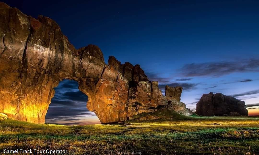
Taikhar Chuluu

Taikhar Chuluu (Taikhar Rock) is one of the tourist attractions when travelling to Arkhangai province. This big 20-metres (66 feet) high rock stands on a bank of Khoid Tamir River in Ikhtamir Soum. It’s covered with 150 writings in many different languages and dating back from many different periods (runic, Sogd, Uyghur, Mongolian, Nangiad, Tibetan writings). The oldest one is the runic writing, related to Turkish period of the 6th and 7th centuries. An ovoo was placed at its top. Unfortunately, there are many graffiti on this rock and the old writings almost disappeared. This cliff was formed by separating from the river bank due to millions of years’ continual flow of Khoid Tamir River through granite cape on its northern bank. The government issued a law to protect the rock in 1994.
Chuluut River

The Chuluut river is the westernmost river that we offer tours on. It starts off in a narrow, steep but not high basalt canyon that is embedded in a landscape of mountainous steppe. It is a wondrous experience traveling between those sheer walls, which occasionally open up to a view of wooded slopes and rich grazing grounds. The Chuluut is also renowned for its fisheries. Since most of it can´t be accessed unless you are in a canoe there are some good opportunities to enrich the menu with fresh Lennox trout.