

MONGOLIA DESTINATION
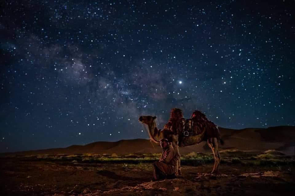
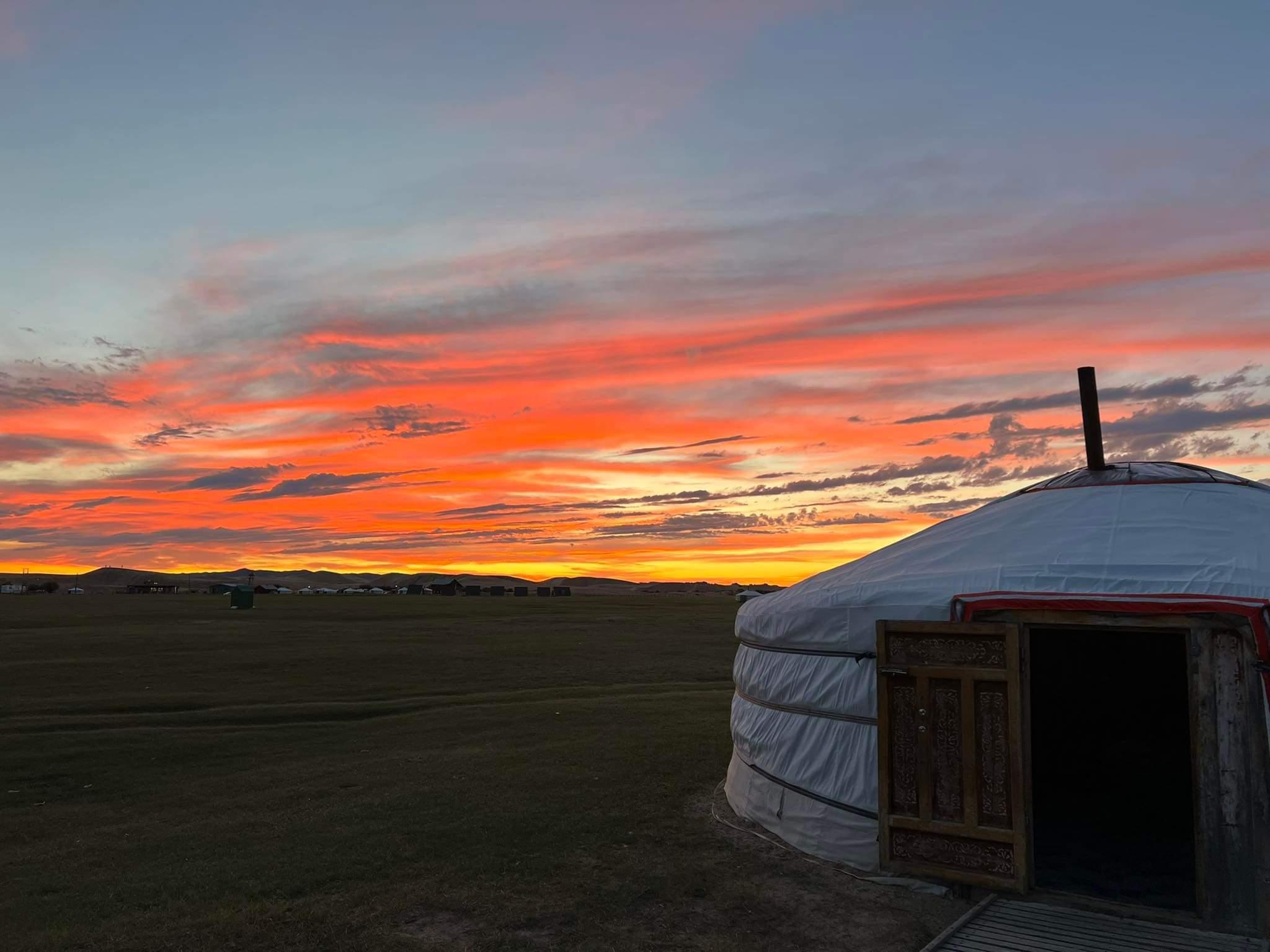
Mongolia is truly one of the world's last undiscovered travel destinations and the safest country to visit. It is a land where you can experience wide-open spaces, cobalt blue skies, forests, deserts, crystal clear rivers and lakes, and the traditional hospitality of the nomads. Permanent dwellings are few and far between, fences even fewer and the land is owned by the people, like one large National Park. As a tremendous destination to experience the outdoors, Mongolia also boasts of unique history dating back to the Mongol Empire of Genghis Khan. Simply put, it is a land of adventure, horses, nomads, and blue sky.
-
Eastern Mongolia
 Khentii, eastern Mongolia is the birthplace of the Great Emperor Chinggis Khaan. It is situated in a region of great natural beauty. It borders in the north with the Russian Federation.
Genghis Khan’s birthplace- Temuujin (Genghis Khan) was the founder and Great Khan (emperor) of the Mongol Empire, which became the largest contiguous empire in history after his demise. He came to power by uniting many of the nomadic tribes of northeast Asia. After founding the Mongol Empire and being proclaimed “Genghis Khan,” he started the Mongol invasions that resulted in the conquest of most of Eurasia.
Highlights: There are many monuments and historical places involved with Chingiss Khaan, Baldan bereeven Monastery
Geologically located to the most eastern and on the vast steppe of Eastern Mongolian Great Plains, Dornod province is one of Mongolian multi ethnic province. The ethnics are Halkh,Buryat, Hamnigan, Uzemchin, Barga all Mongolian. Borders with Khentii to west, Sukhbaatar to the south east Republic of Buryat, Russian Federation, To the south east with Inner Mongolia, Republic of China. The Dornod steppe shows humid and cold weather or dry and cold weather because most of the rainfalls are forced to Khentii Mountain by north and northwest wind. The sunny days per year is 251~260 days, and average annual rainfall is 150~300mm. Average temperature is -15°C~ -25°C winter time, and 18°C~34°C summer.
Khentii, eastern Mongolia is the birthplace of the Great Emperor Chinggis Khaan. It is situated in a region of great natural beauty. It borders in the north with the Russian Federation.
Genghis Khan’s birthplace- Temuujin (Genghis Khan) was the founder and Great Khan (emperor) of the Mongol Empire, which became the largest contiguous empire in history after his demise. He came to power by uniting many of the nomadic tribes of northeast Asia. After founding the Mongol Empire and being proclaimed “Genghis Khan,” he started the Mongol invasions that resulted in the conquest of most of Eurasia.
Highlights: There are many monuments and historical places involved with Chingiss Khaan, Baldan bereeven Monastery
Geologically located to the most eastern and on the vast steppe of Eastern Mongolian Great Plains, Dornod province is one of Mongolian multi ethnic province. The ethnics are Halkh,Buryat, Hamnigan, Uzemchin, Barga all Mongolian. Borders with Khentii to west, Sukhbaatar to the south east Republic of Buryat, Russian Federation, To the south east with Inner Mongolia, Republic of China. The Dornod steppe shows humid and cold weather or dry and cold weather because most of the rainfalls are forced to Khentii Mountain by north and northwest wind. The sunny days per year is 251~260 days, and average annual rainfall is 150~300mm. Average temperature is -15°C~ -25°C winter time, and 18°C~34°C summer.
Meeting Buryat People /Majority of Eastern Mongolians/

The Buryat people are very similar to the Khalkh, descendant of the Mongols who historically lived in the area of Lake Baikal and first became part of the Mongol Empire in the 13th century. There is still debates among researchers on origin of the name Buryat. However, The most likely theory states that the name came from the word bury, meaning wolf, and bury-ata means wolf-father. Nowadays, Buryat People spread throughout between countries of Buryatia, Russia, Mongolia and China.
Khukh Lake-Blue Lake

The full name of the lake is the Blue Lake /Hoh Nuur/ of Black Heart. Black Heart is the pointed topped mountain on the north side of the lake. Blue Lake is a very important place in Mongolian history particularly of Chinggis Khaan (Genghis Khan). Here Temuujin (Chinggis Khaan’s childhood name) was given the title, “Chinggis Khaan”, and was invested as a “The Great Khaan of all Mongolia” in 1189. The stone ruins of a ger with a diameter of 15 meters on the south side of this lake could be the ruins of the palace ger where Chinggis Khaan was proclaimed khaan. There are also wooden statues in the forest dedicated to Chingis Khaan and the next 32 khaans of Mongolia. The surrounding area of Khukh Nuur is quiet, peaceful and wonderful for hiking & relaxation.
Deluun Boldog – The Birthplace of Chingiss Khaan

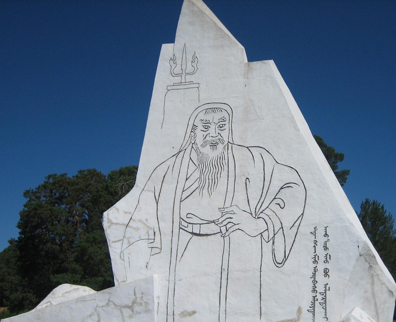
Chingiss Khaan was born into the family of Yesugei Baatar in 1162 at a place called Deluun Boldog by the Onon river in Dadal soum of Khentii aimag. Beginning from 1185, Temuujin directed a military campaign to unite the Mongolian people, which was at that time divided into more than 80 feuding ethnic clans. Finally in 1206 the Great Mongol Empire was established and Temuujin was declared Genghis Khan which meant “Great Khaan”. There are two monuments dedicated to Genghis Khan. One is a large rock in Deluun Boldog with an inscription in old Mongol script marking the birthplace of the Great Khaan. The other monument was inaugurated in 1962 to commemorate the 800th anniversary of Genghis Khan’s birth. It is a life-size figure of Genghis Khan carved on a white stone in the shape of mountain peaks engraved with old Mongol script.
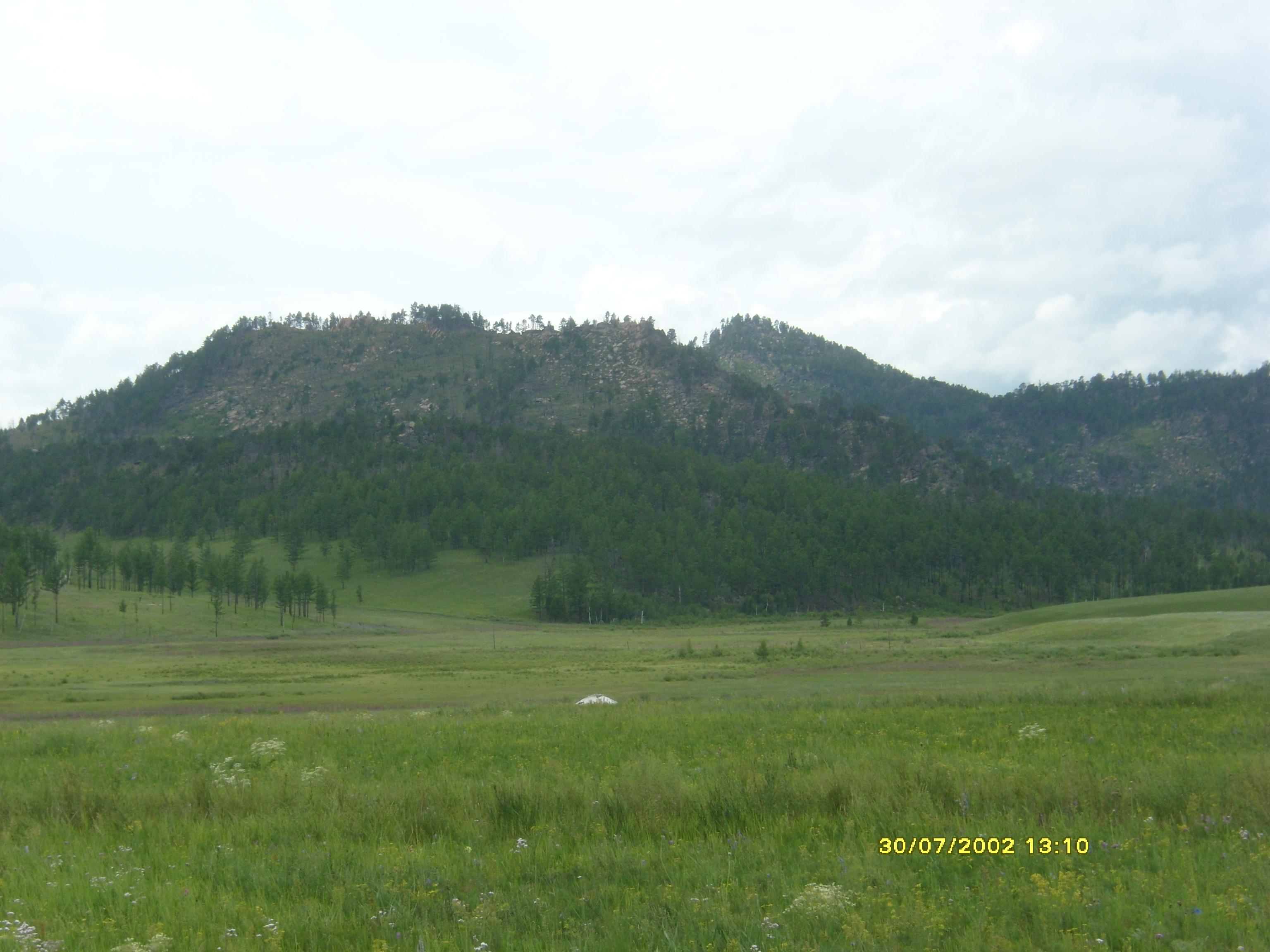
Khan Khentii Mountain National Park

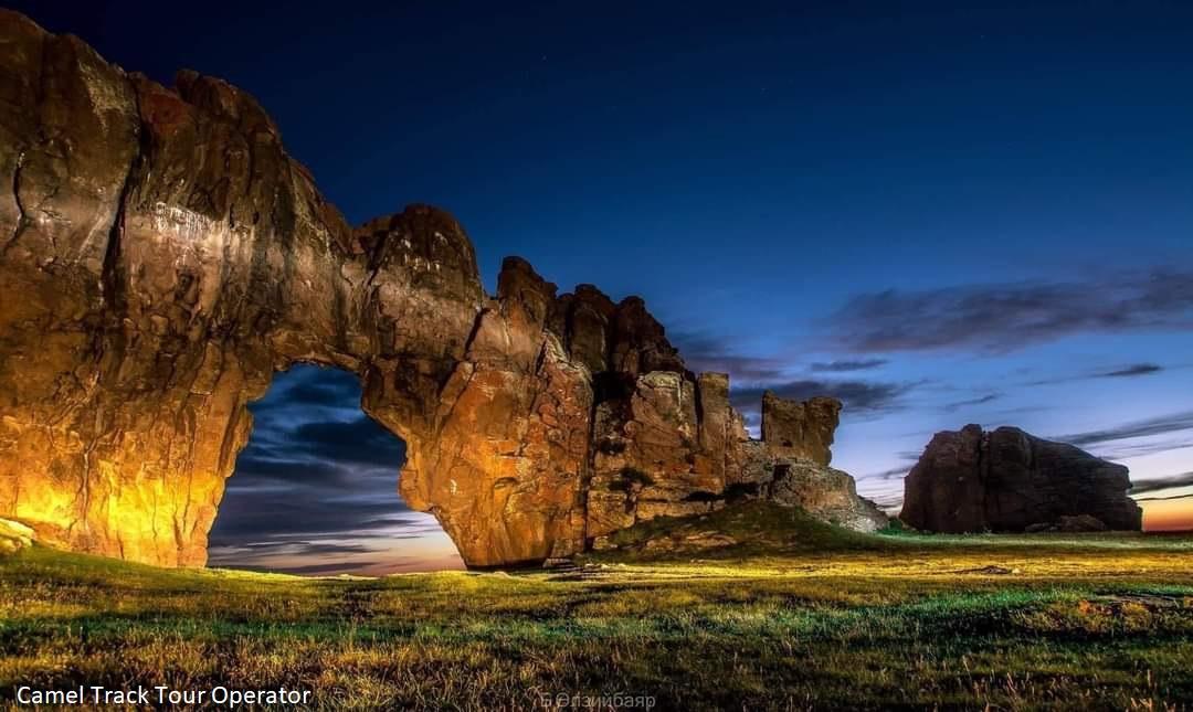
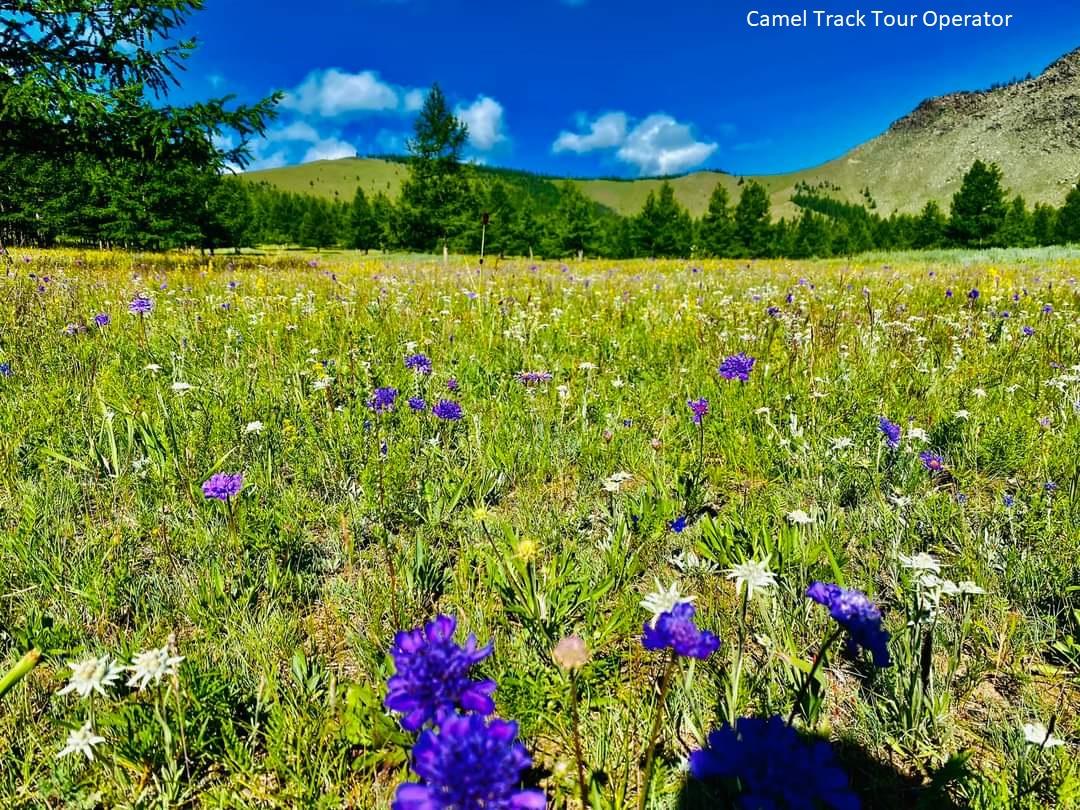
His is the native land of Genghis Khan and contains many important historical and cultural sites. The park is a landscape of transition from Siberian taiga forest to grass steppe. Khan Khentii Mountain National Park is one of the Mongolian natural and historical treasures, declared by UNESCO as a world heritage site. Khan Khentii is covered with forests, taiga, and mountain forest steppe. It is the land described in "The Secret History of Mongols", a literary monument of the nation, and is a protected area located northeast of the capital city. The highest peak of the mountain range is "Asralt Khairkhan", which is 2799 m above sea level.
Baldan Bereeven monastery

Baldan Breeven Monastery is located in small but beautiful valley in the Khan Khentii Mountains, 300 km northeast from Ulaanbaatar. The history of the monastery began in the late 1700s, when His Lofty Noble Holiness Zanabazar sent a group of monks to find a suitable place to establish a monastery in the east of the country. In their search the monks discovered a valley in an extraordinary geographical position, with auspicious omens such as rocks shaped in the form of powerful animals. Construction of the monastery was completed in the 1780s and it became the Buddhist center of the east. Besides that, local people believed that the monastery was the holiest place in the world to go to for a pilgrimage to purify oneself from evil deeds. The monastery was completely destroyed during the 1930s and later reconstructed.
Vast Grassland Menen Steppe

Menen Steppe – The biggest plain area of Mongolia is Menen steppe located in Dornod province. The steppe is located in the west of Buir Lake and is over 90 km long and over 60 km wide. This is the big steppe in the world which has kept its native land and there are a plenty of pasture plants, antelopes, wolves as well as rare animals. Usually Mongolian antelopes graze and hundreds of them flock and pass winter here. You can see the beauty of the steppe where the perennial, nutritious and segmented grass swings in the Menen steppe. You will feel to exclaim what a grass sea. The eastern region aimags are the home to Mongolian antelopes which have now become very rare in the world. The halves of the antelopes out of three millions in Mongolia flock only in Dornod province. It is impossible to separate native feather grass, huge flock of antelopes and famous Menen Steppe.
Shiliin Bogd Mountain

The volcano Shiliin Bogd is 60 kilometres southeast center of the village of Dariganga. It's 1778 above sea level, the highest of the province of Sukhbaatar. Its crater is 2 kilometres wide and 300 metres deep. The extinct volcano is sacred to many Mongolians: the spirit of any man (and man only!) who climbs it, especially at sunrise, will be revived. The region is stunning, isolated and close to the Chinese border – so be careful. There are plenty of ovoos and awesome views of craters all around. About 3km to the south, the fire break that squiggles into the distance is the border with China. On the road between Dariganga and Shiliin Bogd, 8km past Ganga Nuur, look out for the statue of Toroi-Bandi, the Robin Hood of Mongolia, who stole horses from the local Manchurian rulers, then eluded them by hiding near Shiliin Bogd Uul. The statue, dedicated in 1999, pointedly faces China.
Taliin agui - Steppe cave

Just in 15 minutes drive from Shiliin Bogd mountain, you can reach one of the Mongolian largest caves. It is interesting formation of caves as it was formed in steppe area, not in mountains. This large sized and a little claustrophobic cave has seven chambers to explore. If the ice covering the entrance has melted (it's normally covered until August) you can squeeze through the narrow entrance.
Ikh Burkhant Buddhist God Figure

Ikh Burkhant complex is an important historical as well as cultural and astronomical sight of Mongolia. The god is placed in the area in 1859-1864 by initiative of Togtochtur, known as To Van throughout Mongolia. To Van, a young descendent of Chinggis Khan, was re-quilified in astronomy and he could predict that his birthplace - Khalkh River basin area will be conquired by foreign attackers. Therefore, to protect his birthplace, he started the job to stop the future conquire with the help of Buddhism. To Van and his friends buddhist monks erected Janraisag, a god believed to protect from 8 dangers, was erected horizontally on west bank of the Khalkh River as a symbol of protection of the eastern border and security of territorial integrity. Since that time the area is known as Ikh Burkhant by local people. On a donation of local aristocrats and lamas the 90 feet long /or 30m/ deity was built of stones carried by 1000 ox carts with a work of almost 100 craftsmen. The creation of 12 stupas alongside the god and 2 dictaturing scaring gods of Skeleton Gods- God against Robbing, as well as about 20 small gods surrounding it made the complex so unique and attractive destination.
Khalkh gol - Khalkh river

The biggest river in Dornod area is Khalkh River. The west bank of the river is taller than the east bank. If you see from the east bank, it looks like wall that covers over, so that it is called as “Khalkh” river which means “shield” in Mongolian. The river that flows through Khalkhgol soum of Dornod aimag is 233 km long and flows into Buir Lake determining the border line between Mongolia and China. The Khailaast River flows into the Khalkh River. In 1939 an undeclared war was held between Japan - Manchu and The Soviet Union – Mongolia near the Khalkh River.
Oglogchiin herem - Ansector's wall
Uglugchiin herem is located 45 km in south west of Batshireet soum center of Khentii aimag and 8-10 km from the delta of Bayan River and Uglugchiin River. It lies in a valley of Daichin Mountain and was built with skillfully piled stones without any clays and mud. It is about three kilometers long and it has two entrances, in south and north sides. There is a small soil dam remainder inside and piling of this wall can be clearly seen from its south east and south sides. Other parts became too difficult to distinguish from earth. The height of the wall was 2.5-4.5 meters when a Soviet archeologist S.Kondratiev measured in 1926, but its highest point is 3.1 meters and 2, 5 meters wide now. A tall rock inside the wall is called as “Horse handle of Chinggis Khaan” by local people. There was no trace of building and at the Uglugch wall and S.Kondratiev thought it was the stronghold of archers of 12-14 century because of earth leveled up to the wall height inside. Kh.Perlee said that it belongs to Khyatan time because of its clay and ceramic remaining. But there was not any writing about Uglugch wall and it located far beyond than Khyatan’s land at that time.
Buir lake Nature Reserve

Buir Nuur is not only a very beautiful lake also the largest on east Mongolia, being 21 kilometers wide, 40 kilometers long and covering 615 square kilometers. 3-5 m high sand dyke was formed from surf on southern bank of the lake and in-between them small lakes were formed some of which connected to the largest body of water. Khalkh river flows into the lake and Orshuun river flows out of the lake, so thicket of willows and sugar canes were grown alongside the lake. The lake water, which is rich of hydro-carbonate, sodium chloride and calcium, is indeed very fresh and clear. The lake is home to Mirror Carp, Taimen, Chub, Lenok, Amur Graying, Pike, Khadary, Silver Carp, Amur Catfish, Burbot, Whitefish, and Golden Carp. A fishery is developed, and an estimated 300 tones may be landed annually. The main game fish is Amur Carp. Black Stork, White Spoonbill and Little Whimbrel are common.
Ruins of Kherlen Bars

Ministry of Culture, Sport and Tourism of Mongolia and State Administration of Cultural Heritage signed a cooperation agreement to restore and repair the ruins of an ancient urban settlement Kherlen bars in Mongolia. The agreement was inked by Altangerel Purev, State secretary of the Mongolian Culture, Sports and Tourism Ministry, and Yang Qingdong, Political counsellor at the Chinese Embassy in Mongolia on June 13th. Kherlen bars, some small-scale ruins and a 3 m high tower from a 12th century city, once part of the ancient state of Kitan is one of the ancient monuments remained in Mongolia. Under the agreement Chinese and Mongolian specialists will restore the unique site.
Altan Ovoo Sacred Mountain
The skyline of this steppe area is distinguished by Altan Ovoo, a wide former crater topped by a new stupa, which only men are allowed to visit. The stupa was built in 1990 on top of the ruins of old Battsaagan stupa, which was built in 1820 and destroyed in 1937.There are dozens of broken balbal - their exact origins are not clear. There are also three main balbals known as the king, the queen and the prince, nearby it there are some hay sheds. According to local tradition, you should offer some food in the cup on the statue's left hand.
Ganga lake Nature Reserve

Ganga Lake Nature Reserve is reserved in 1996 as to protect the flora and fauna of this sacred land and unique heritage of silversmiths. It covers 28000 hectare area and 6 lakes. The three main lakes, Kholboo Nuur, Tsagaan Nuur and Ganga Nuur, are good for bird watching and outdoor tent camping. By the end of August and the beginning of October, the lake is home to thousands of migrating swans, and it is exact time for bird photographing.